
I have an idea. Instead of just visiting all 50 states, why not summit the tallest peak in each of the 50 states? Sure, in some cases this is not that exciting, like in my birth state of Indiana, for example. The highest point of Indiana is just a spot you drive to and walk a short distance. Woo. But in the western states, there are actual mountains to climb, and how cool would it be to say I’ve reached the highest point in all 50 states?!
Whether I accomplish that or not, I could at least start with my current home state’s highest peak. That would be Guadalupe Peak located in Guadalupe Mountains National Park. This is actually one of the least visited National Parks in the country, ranking 48/59 in 2016 with 181,839 visitors (for comparison, the #1 park was Great Smoky Mountains with over 11 million!). Given its location, that does make some sense. In the middle of the Permian Basin, oil wells dominate the region, and there are no cities or even large towns nearby. There are no hotels within about an hour of the park, and the campgrounds are small. It’s just not an easy park to visit, especially if you plan on staying for more than a day or two.
For me it was about an 8 hour drive. In order to accomplish this over a weekend, I had to leave immediately following work on Friday evening, drive to Midland (about 5 hours) and stay the night, then get up early (I mean REALLY early; 4 am!) to complete the drive and begin the hike by sunrise. So that is what I did!
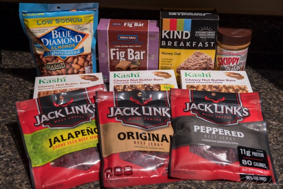
Preparation is the key to success. If I were to complete this hike, I’d definitely need plenty of fuel! Take a look at my selection of goodies!
I started my hike just before 8 am. It’s 4.2 miles from the trailhead to the summit, with a gain in elevation of just over 3,000 feet to reach the summit at 8,749 feet above sea level. This park is known for its wind, so I had watched the weather for a while, and found a weekend with almost no wind. It was also pretty warm, so the long-sleeve shirt and jacket I had with me were not even needed.


Wildlife in this park includes black bears, mountain lions, and mule deer, among others. I didn’t see any bears or mountain lions, but I did run into a few mule deer. Two grown females, and three young ones, probably yearlings.
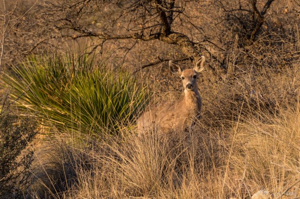
They weren’t too sure about me, but they didn’t run away, either. I always love running into wildlife. Such a treat! Love these animals!
The first mile or mile and a half of this trail is the steepest. Good news and bad news, I guess. You certainly don’t ease into the hike, but on the plus side, you get the hardest part out of the way first. It also means the views get pretty spectacular pretty quickly.


You get a little bit of everything on this trail. There is some loose rock, some slick rock, open desert area, and pine forests. In the morning the trail starts in the sun, but then goes into the shade on the western slope, as the trail levels out somewhat. It’s a welcome break after that initial steep ascent in the sun.
Perhaps my recent increased activity level helped, or perhaps it was due in large part to frequent stops to take photos, but this hike ended up being less strenuous than I had anticipated. It took 3 hours and 15 minutes for me to reach the summit from the trailhead. Without all of the breaks, I think if I really pushed it I could do it in around 2 and a half hours.


There’s a big silver pyramid marking the summit, with a lock box containing a register. I signed the register, and took a break to eat a few Kashi bars, drink some water, and take some photos at the summit.


I’m well aware of the fact I’m not making any fashion statements with that outfit! But that was the only moisture-wicking shirt I had, and the shorts are actually convertible pants, which are very convenient when you’re not sure what the temperatures are going to be like.
Going up is your cardio workout, and coming back down is without a doubt your leg workout! My quads were burning by the last mile, and of course that would be the steepest part! It’s almost easier to jog down. I did not take any breaks on the way down, and it only took an hour and a half!
At that point I took the opportunity to get my entrance sign selfie, and then decided to head up to Carlsbad Caverns (about 45 minutes north).


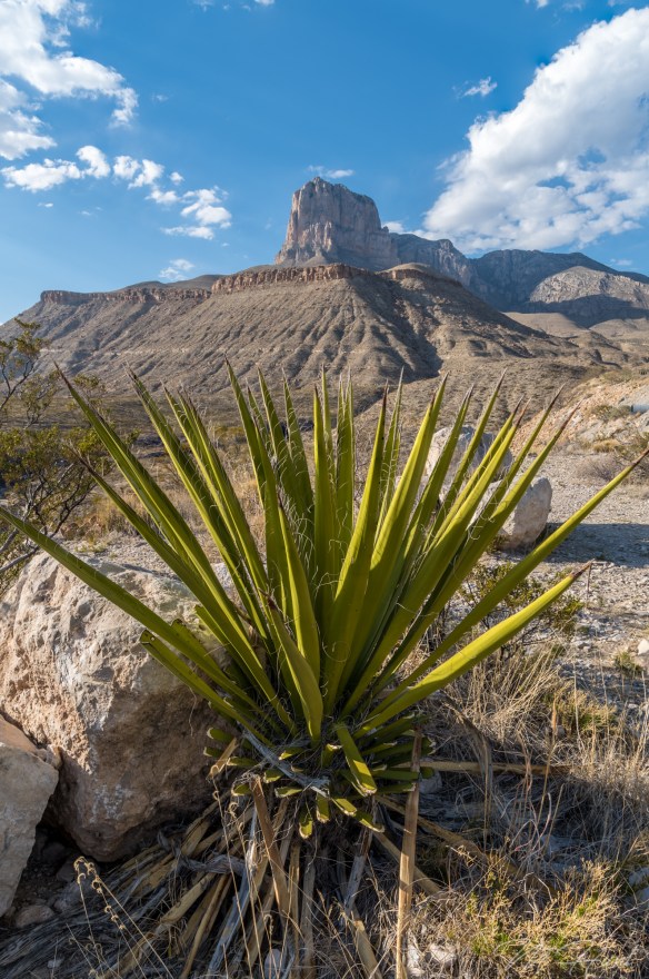
I had originally planned on camping at the park and going to Carlsbad Caverns in the morning, but the campground was full. As it turned out, that was a very bad time to visit Carlsbad Caverns. It was absolutely packed, and I just didn’t have time to go through it all, so I was in and out, and did not see the most interesting sections. Oh well. I had to get to the next spot that I wanted to photograph, which was the salt flats! But first, I had to stop and get the iconic shot of El Capitan!
Then it was off to the salt flats. I assumed it was okay to drive on them. There were no signs to tell me otherwise! There were also plenty of tire tracks, so out onto the flats I went. Pretty cool place!
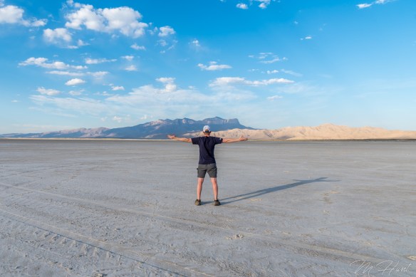
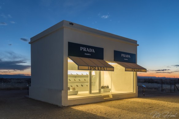
That would be a really great spot to shoot the sunrise. Maybe some other time. After that I made the drive to Prada Marfa. It is located in the middle of nowhere on US-90 in southwest Texas. No, it’s not an actual Prada store. It’s a sculpture by artists Elmgreen and Dragset. It’s not even in Marfa, it’s in Valentine. Marfa is another 26 miles to the southeast.
It originally contained actual Prada shoes and purses, but was vandalized 6 days after it was completed, and those items were stolen. They were then replaced with knock-offs.
Since my camping plans were spoiled, I then decided to drive all the way to Odessa to stay in a hotel room for the night. I was completely exhausted by the time I got there, but it left me with just a little over a 5 hour drive on Sunday to get back home. So it was really a one-day adventure, lasting about 20 hours! Carpe diem!
Here is a vlog I put together on my hike to Guadalupe Peak. In the future I plan on either getting a dedicated camera for this, or at least a gimbal to stabilize the phone shots.
