I finally made it out to Quanah Hill after several suggestions from my subscribers on YouTube! I would say it did not disappoint!
The overall elevation after a full lap is still well under 1,000 feet, but the elevation changes are far more drastic than most North Texas trails. Steep climbs, followed by steep descents. At least in some sections. There are a couple of longer, more gradual downhill runs that still benefit from a few pedal strokes if you want to do more than just cruise down the trail.
It’s about an hour drive for me to get out there, which isn’t too bad. I’ll definitely go back! Check out the video!
It wasn’t just another day of riding last Saturday. It also wasn’t the first time I woke up at 4:30 am to go do something fun.
I’d be making the 3.5 hour drive down south to Austin to ride a trail on private property. You won’t find this trail on MTB Project or Trail Forks. You’ll need to be a member of Freeride 512, or be with a member in order to ride it. In my case, I’d not only be riding with a member, but the main builder of these trails. Oh, and I’d also be riding with a YouTuber named BKXC. You may have heard of him before.
He wasn’t the only YouTuber, and I wasn’t the only other one. Also there was the man of Austin, Eric from No Front Brakes, Tony from MTB Drop In, and my friends Chris CXK & Cobra Kyle. We had a crew!
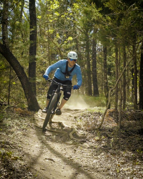
Brian (BKXC) and the local guys were pretty fast. They all jumped out ahead of the rest of us YouTubers. We struggled to breathe as we mainly walked up the steep climbs, and just tried not to slide off the hill on the descents! Seriously though, these trails are tough, but boy are they sweet! Seth, who is the main trail builder I spoke of earlier, has also added many wood features, like drops & jumps. Most of them were well beyond my pay grade.
This really is one of the best ways to improve as a rider, though. Ride trails that have features just a step above your current skill level. Try one new feature, or a more difficult line on a feature each time you ride, and your progress will be exponential. In my case, I did a little bit of this, but looking back on it now, there were some things that I skipped that I now wish I would have gone for!
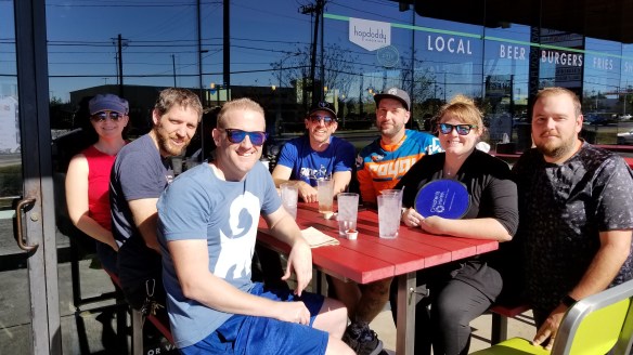
After the ride, Brian, Eric, Chris, his wife, Kyle, his girlfriend, and myself all went to Hopdoddy to chow down on some burgers and hang out! It was cool to actually meet Brian, but after watching his videos for so long it was as if I had met him already. Kind of a weird thing! All in all it was a great time, and we were also blessed with great weather! Doesn’t look like we’ll be so lucky on that front this coming weekend!
A couple weeks ago I took a crazy trip to Big Bend! Why was it crazy, you ask? Because Big Bend is a 9 hour drive, and I did it on a normal weekend.
I left work at 5 pm on Friday evening, and after fighting the DFW traffic & rain (which makes traffic about 8 gazillion times worse) I arrived in Terlingua at around 2:15 am. I “slept” in my car at a free campsite, waking before the sunrise.
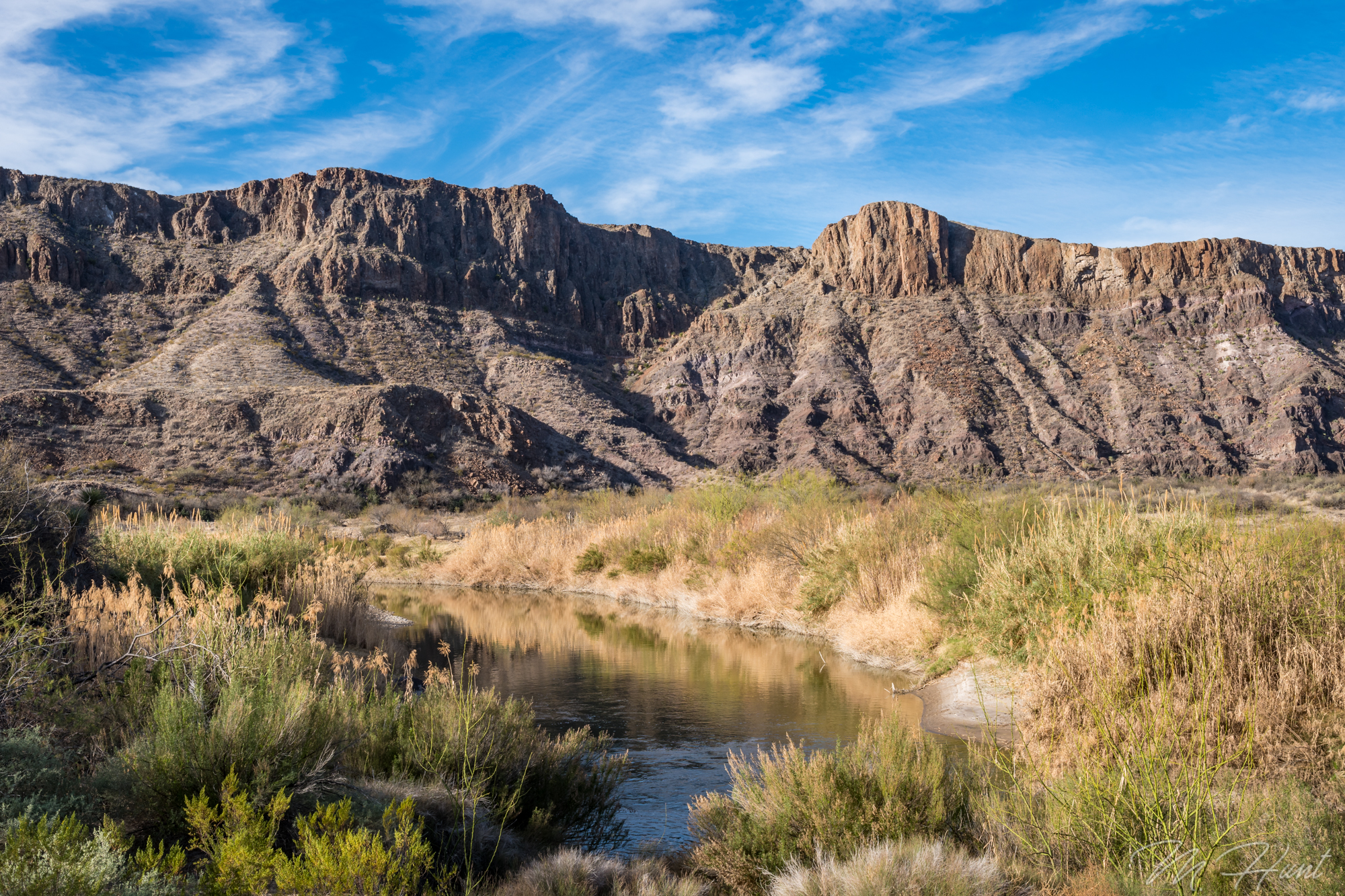
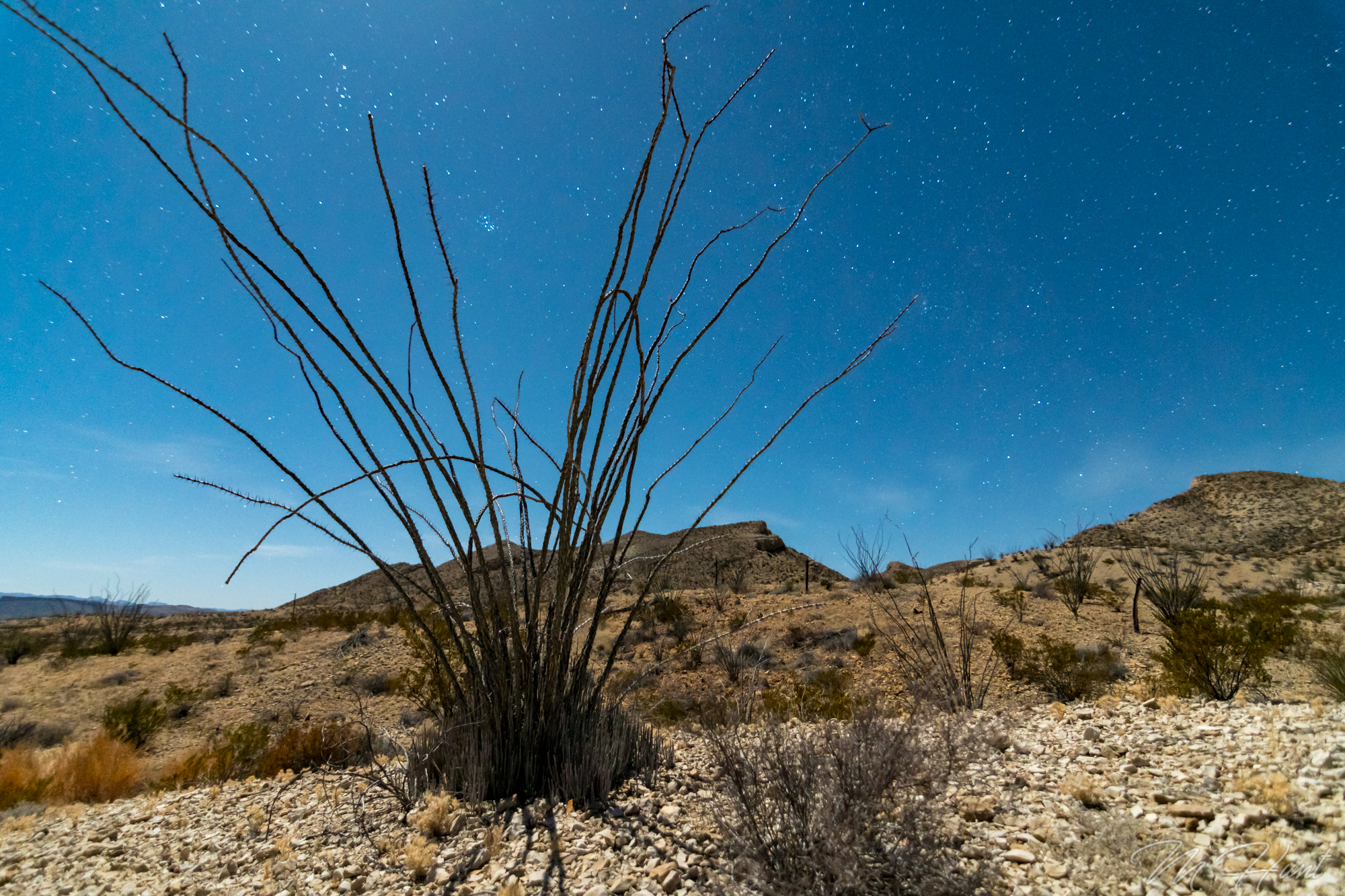
I went out from there to take some photos and video, and then went mountain biking on the Dome Loop in Big Bend Ranch State Park.
I met some great people in the parking lot of the visitor’s center, Danny & Darlene, and went biking with Danny, then hung out with them afterward in their Sprinter camper van. They have been traveling the country while living in the van for the past 11 months! I’m jealous!
That night I stayed at a legit campsite, which was amazing, and the moonlight lit up everything!
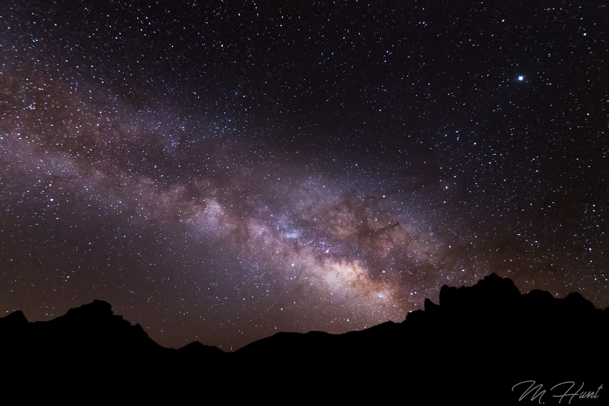
After a much better (but chilly) night of sleep, I rose super early to make a 45 minute drive to Big Bend National Park to shoot the Milky Way.
Sunday morning was the Lajitas Airport trails, and then the 9 hour drive back home!
Don’t let a lack of money or lack of time keep you from traveling. This trip cost roughly $100 (gas + $10 for the campsite) and didn’t require any PTO time. Yes, I spent 18 hours of my weekend driving, and far less than that sleeping, but you only get one life, so CARPE DIEM! The memories are worth far more than the time and the money spent.
I have an idea. Instead of just visiting all 50 states, why not summit the tallest peak in each of the 50 states? Sure, in some cases this is not that exciting, like in my birth state of Indiana, for example. The highest point of Indiana is just a spot you drive to and walk a short distance. Woo. But in the western states, there are actual mountains to climb, and how cool would it be to say I’ve reached the highest point in all 50 states?!
Whether I accomplish that or not, I could at least start with my current home state’s highest peak. That would be Guadalupe Peak located in Guadalupe Mountains National Park. This is actually one of the least visited National Parks in the country, ranking 48/59 in 2016 with 181,839 visitors (for comparison, the #1 park was Great Smoky Mountains with over 11 million!). Given its location, that does make some sense. In the middle of the Permian Basin, oil wells dominate the region, and there are no cities or even large towns nearby. There are no hotels within about an hour of the park, and the campgrounds are small. It’s just not an easy park to visit, especially if you plan on staying for more than a day or two.
For me it was about an 8 hour drive. In order to accomplish this over a weekend, I had to leave immediately following work on Friday evening, drive to Midland (about 5 hours) and stay the night, then get up early (I mean REALLY early; 4 am!) to complete the drive and begin the hike by sunrise. So that is what I did!
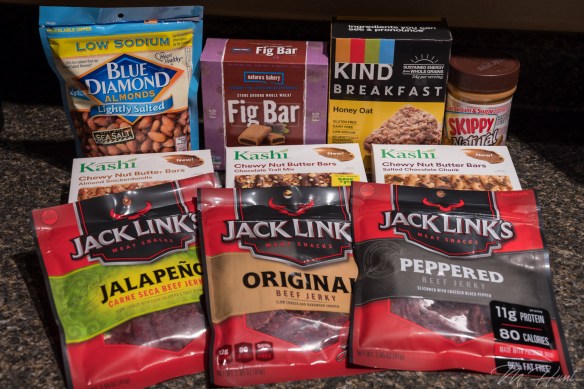
Preparation is the key to success. If I were to complete this hike, I’d definitely need plenty of fuel! Take a look at my selection of goodies!
I started my hike just before 8 am. It’s 4.2 miles from the trailhead to the summit, with a gain in elevation of just over 3,000 feet to reach the summit at 8,749 feet above sea level. This park is known for its wind, so I had watched the weather for a while, and found a weekend with almost no wind. It was also pretty warm, so the long-sleeve shirt and jacket I had with me were not even needed.
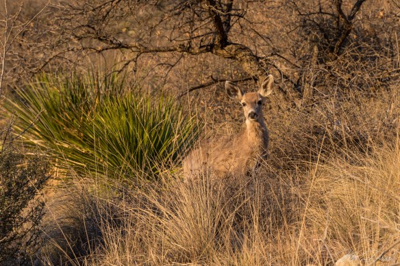
Wildlife in this park includes black bears, mountain lions, and mule deer, among others. I didn’t see any bears or mountain lions, but I did run into a few mule deer. Two grown females, and three young ones, probably yearlings.
They weren’t too sure about me, but they didn’t run away, either. I always love running into wildlife. Such a treat! Love these animals!
The first mile or mile and a half of this trail is the steepest. Good news and bad news, I guess. You certainly don’t ease into the hike, but on the plus side, you get the hardest part out of the way first. It also means the views get pretty spectacular pretty quickly.
You get a little bit of everything on this trail. There is some loose rock, some slick rock, open desert area, and pine forests. In the morning the trail starts in the sun, but then goes into the shade on the western slope, as the trail levels out somewhat. It’s a welcome break after that initial steep ascent in the sun.
Perhaps my recent increased activity level helped, or perhaps it was due in large part to frequent stops to take photos, but this hike ended up being less strenuous than I had anticipated. It took 3 hours and 15 minutes for me to reach the summit from the trailhead. Without all of the breaks, I think if I really pushed it I could do it in around 2 and a half hours.
There’s a big silver pyramid marking the summit, with a lock box containing a register. I signed the register, and took a break to eat a few Kashi bars, drink some water, and take some photos at the summit.
I’m well aware of the fact I’m not making any fashion statements with that outfit! But that was the only moisture-wicking shirt I had, and the shorts are actually convertible pants, which are very convenient when you’re not sure what the temperatures are going to be like.
Going up is your cardio workout, and coming back down is without a doubt your leg workout! My quads were burning by the last mile, and of course that would be the steepest part! It’s almost easier to jog down. I did not take any breaks on the way down, and it only took an hour and a half!
At that point I took the opportunity to get my entrance sign selfie, and then decided to head up to Carlsbad Caverns (about 45 minutes north).
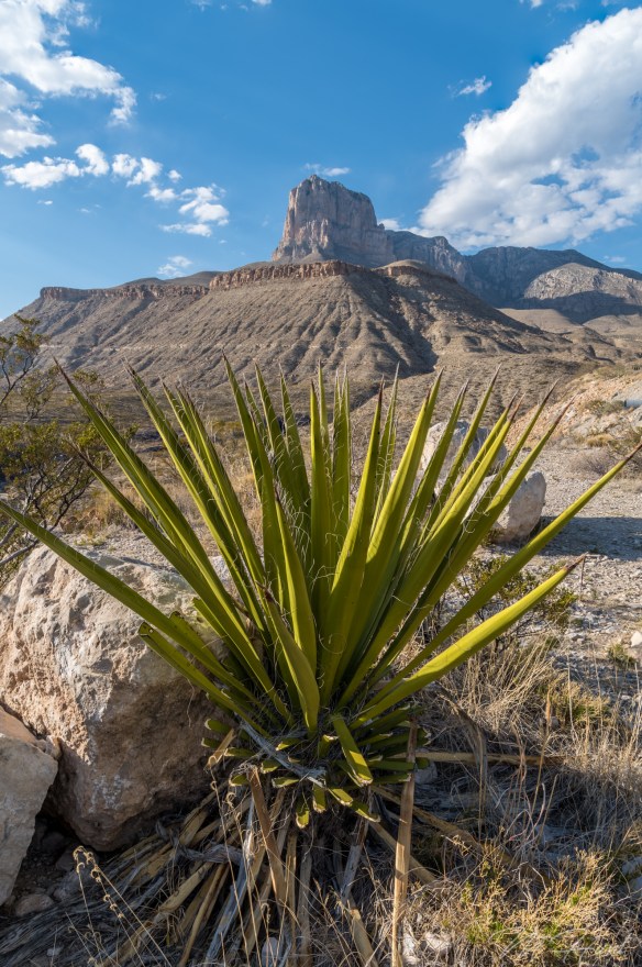
I had originally planned on camping at the park and going to Carlsbad Caverns in the morning, but the campground was full. As it turned out, that was a very bad time to visit Carlsbad Caverns. It was absolutely packed, and I just didn’t have time to go through it all, so I was in and out, and did not see the most interesting sections. Oh well. I had to get to the next spot that I wanted to photograph, which was the salt flats! But first, I had to stop and get the iconic shot of El Capitan!
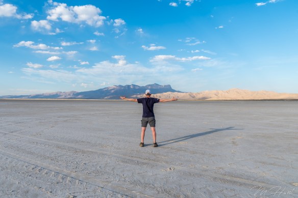
Then it was off to the salt flats. I assumed it was okay to drive on them. There were no signs to tell me otherwise! There were also plenty of tire tracks, so out onto the flats I went. Pretty cool place!
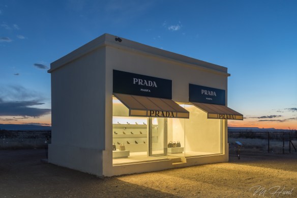
That would be a really great spot to shoot the sunrise. Maybe some other time. After that I made the drive to Prada Marfa. It is located in the middle of nowhere on US-90 in southwest Texas. No, it’s not an actual Prada store. It’s a sculpture by artists Elmgreen and Dragset. It’s not even in Marfa, it’s in Valentine. Marfa is another 26 miles to the southeast.
It originally contained actual Prada shoes and purses, but was vandalized 6 days after it was completed, and those items were stolen. They were then replaced with knock-offs.
Since my camping plans were spoiled, I then decided to drive all the way to Odessa to stay in a hotel room for the night. I was completely exhausted by the time I got there, but it left me with just a little over a 5 hour drive on Sunday to get back home. So it was really a one-day adventure, lasting about 20 hours! Carpe diem!
Here is a vlog I put together on my hike to Guadalupe Peak. In the future I plan on either getting a dedicated camera for this, or at least a gimbal to stabilize the phone shots.
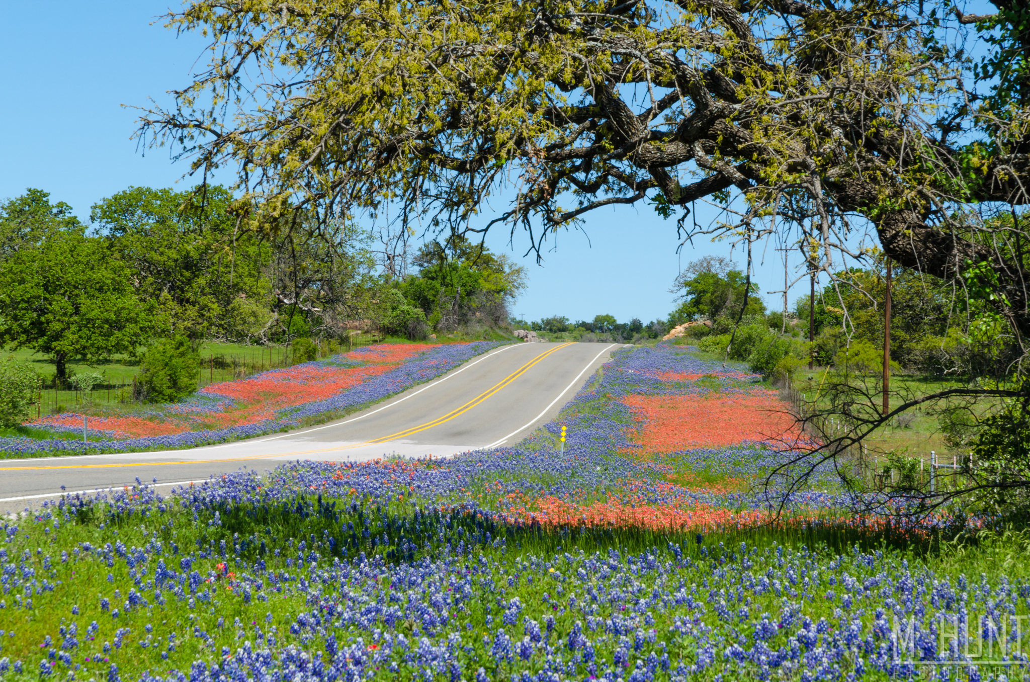
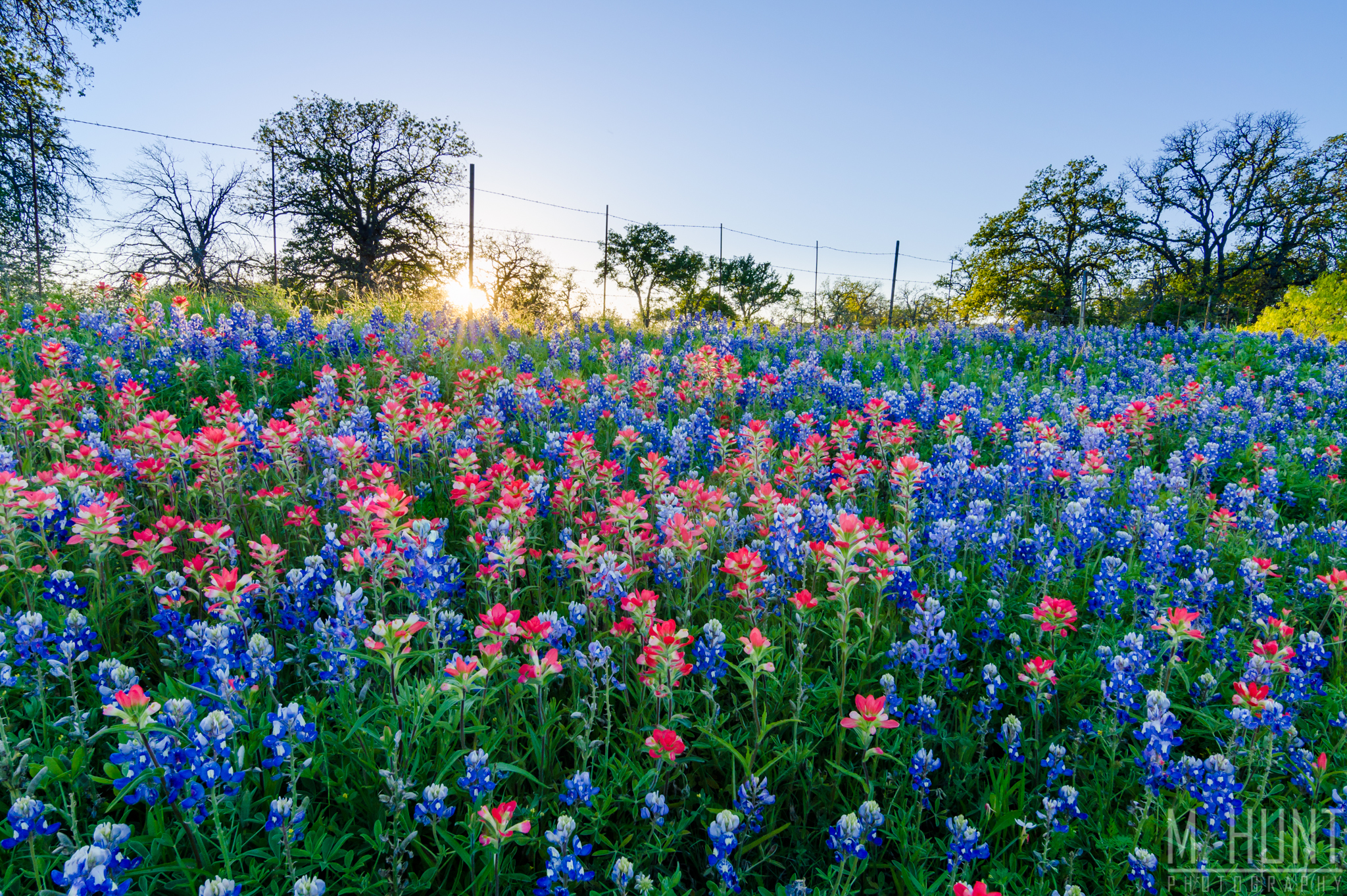
It’s spring in Texas, which means it’s wildflower time! The Texas bluebonnet (Lupinus texensis) is the official state flower, and while you may find a few in Oklahoma, Louisiana or Florida, it’s primarily a Texas thing! I had originally planned on traveling to Ennis this past weekend, where there are large fields full of bluebonnets, but reports from the area stated they are not in full bloom. In fact, it may be an off year for the Ennis fields. Thankfully, the bluebonnets, Indian paintbrush, and other wildflowers were in full bloom in the Texas Hill Country, especially in and around Llano, TX.
Patches of various wildflowers were on display along the side of the road from Dallas all the way to Llano. The fields became truly brilliant near Baby Head Cemetery.
I continued south on SH 16 and out RR 965 to Enchanted Rock where I was planning on hiking to the top. Unfortunately the park was closed when I arrived, and while it appeared to be temporary, there was already a long line of cars along the side of the road waiting for them to re-open, so I decided to skip that. There were several more thick beds of bluebonnets and Indian paintbrushes along the sides of RR 965, which is where I got this close-up view of the Indian paintbrush with the bluebonnets behind it.
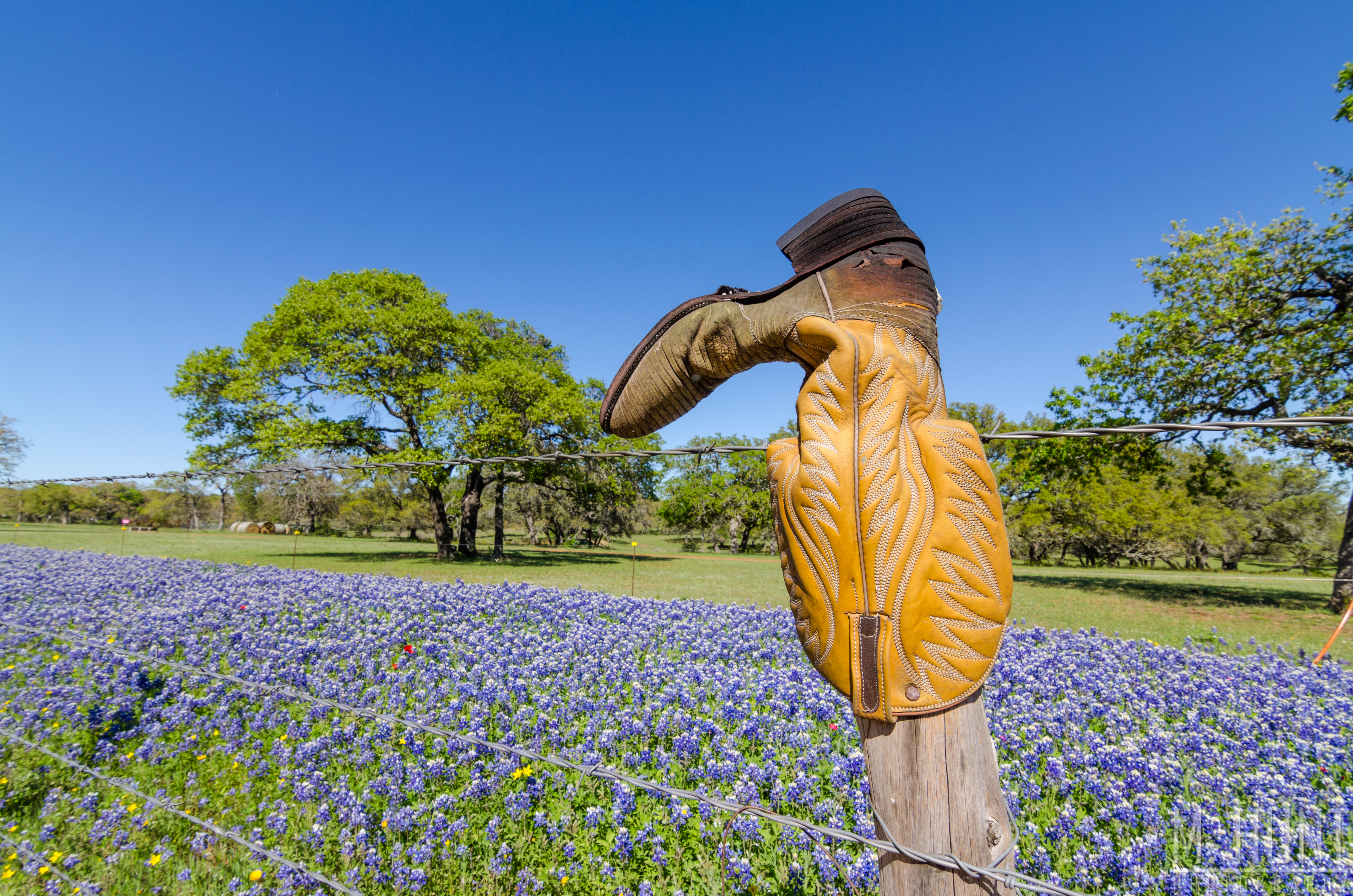
After that I continued south on SH 16 to the Willow City Loop. This is a scenic loop with a lot of wildflowers, prickly pear cactus, oak trees, and the rolling hills that make this part of Texas so beautiful! The Willow City Loop is also home to the famous “boot fence” where each fence post is adorned with a cowboy boot.
Cowboy boots and bluebonnets… the only thing missing is a longhorn, and that’s about as Texas as you can get!
I took some photos at the railroad tracks near Buchanan Dam, but they did not turn out well due to the angle of the sun at that time of day. I should have been at that location much earlier in the day.
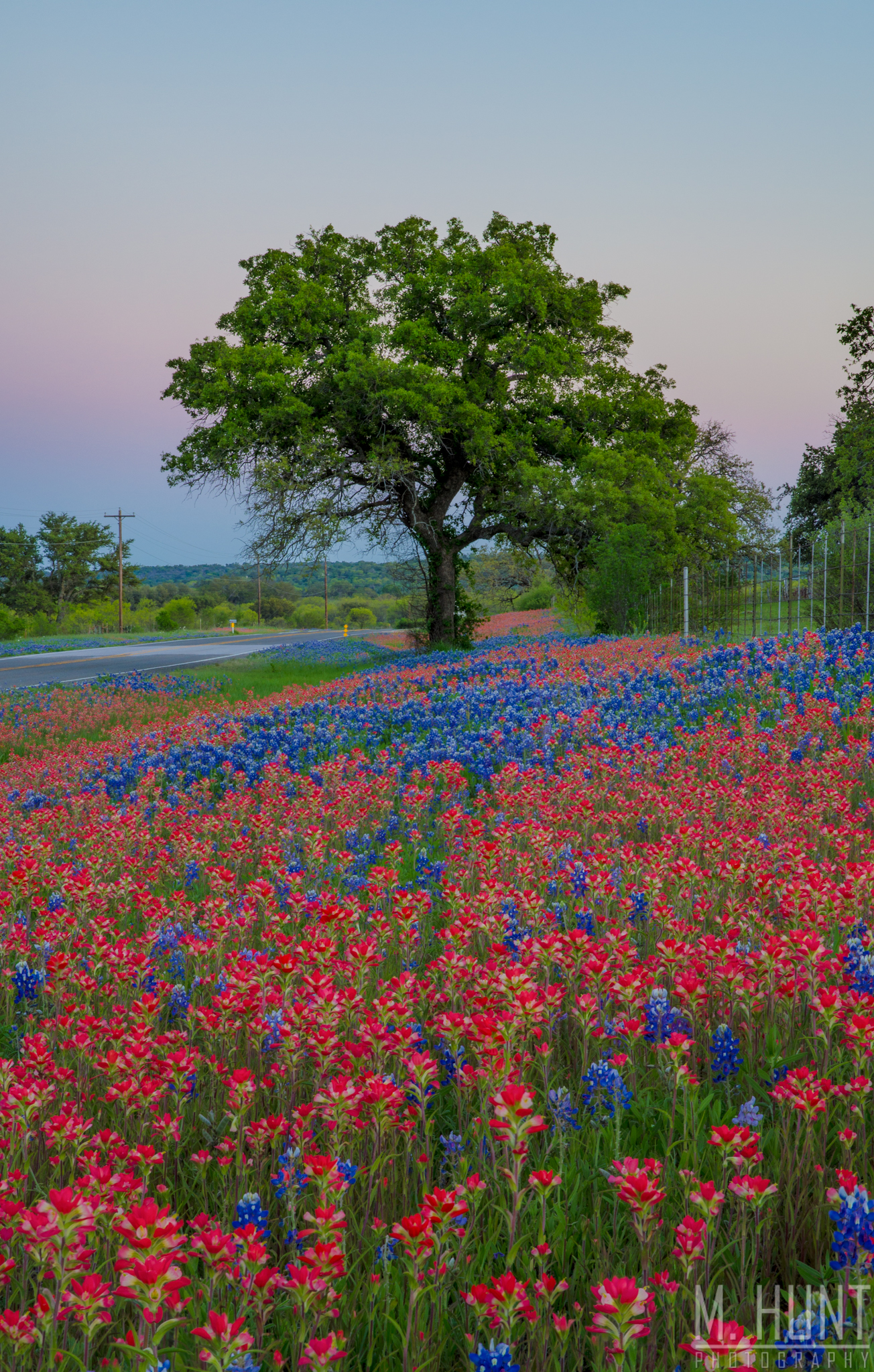
As sunset approached, I ventured back to the area around Baby Head Cemetery, as these were the best looking fields, with both sides of the road covered in a sea of red & blue.
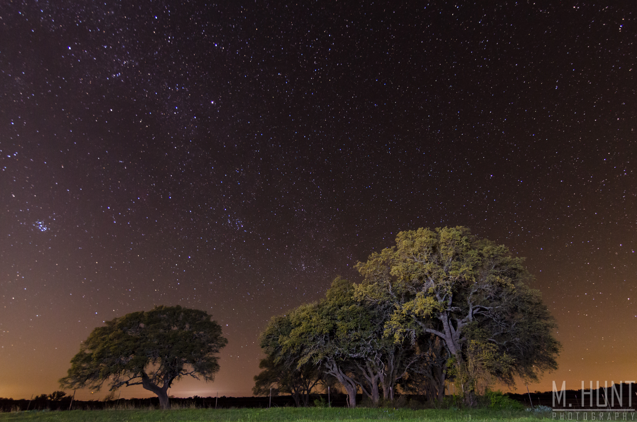
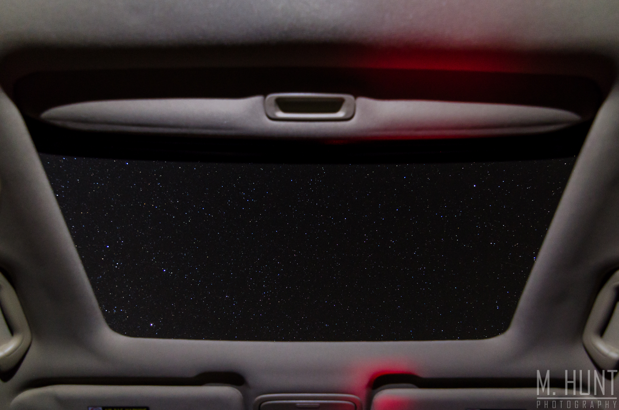
On the drive back up to DFW, I just happened to look out my window from the rural pavement of FM 2005 somewhere northeast of Goldthwaite, and noticed how brilliant the stars looked! I had to find a place to stop and get some pictures! After several failed attempts, missing side roads and driveways until I was past them, I finally decided to let the car behind me go in front, slowed down, and found a good spot. I didn’t even realize I had stopped in a perfect location with some trees (bur oak, maybe?) on the other side of the road. It was a perfect opportunity to do some light painting with my new flashlight that I got for just that purpose! It turned out great!
Prior to leaving that area, I had one more idea! While the image above was shot at ISO 1600 (f/2.8, 20 secs), for the one below I wanted to capture a more realistic view of what could be seen with the naked eye out there. I used the same settings, but turned the ISO down to 250. This is still a little more than what I could pick up with my own eyes, but it’s not too far off! It’s also a perfect display of what I love about having a sunroof!
I hope you enjoy looking at these photos as much as I enjoyed taking them!